The Columbia River
The Columbia River
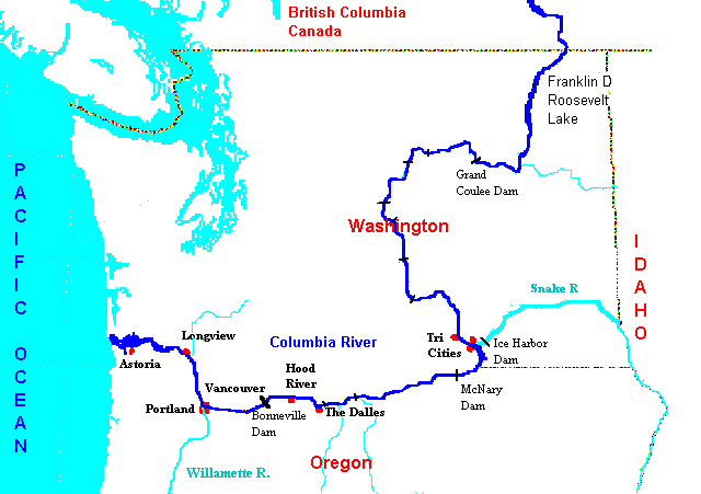
The Columbia is the major river of the northwest United States. Starting in British Columbia, Canada, it flows through eastern Washington state, then forms the border between Washington and Oregon until it reaches the Pacific Ocean. Because of the dams and locks, it is possible to navigate the Columbia and Snake rivers as far as Idaho. The Columbia's lower reaches are tidal with many sloughs, above that it passes through the Cascade Mountains in a
magnificent gorge and then through the drier eastern side of the Cascades.
There is a fine relief map (300k) of the area,
a general map of the region available through the Xerox map viewer,
my rough map of the
US portion of the Columbia
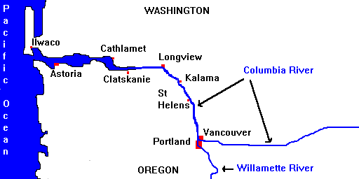
and my slightly more detailed map of the lower Columbia with some additional town names included.